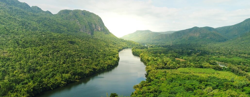
Rivers are a major part of the hydrological cycle. Water which does not evaporate flows downhill across the land surface where it forms small rivulets which then merge together to form gullies and streams. As more and more water accumulates some streams become rivers which can then receive water from other rivers known as tributaries. How a river behaves, and what it looks like, depends on its rate of descent, its volume of water, and the geology of the landscape it is in.
Take a look at these 11 awesome facts about rivers.
Interesting River Facts
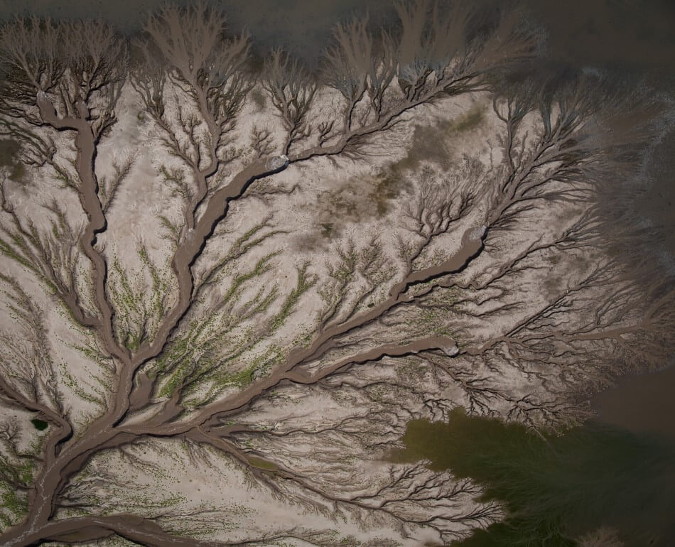
1. Watersheds, or drainage basins, are the terms used by geologists to describe an area in which rivers and streams collect all the surface flow, and transport it to a single point at a lower elevation.
An area of high land, usually mountain ranges or hills, which separate watersheds is called a watershed divide.
A prime example of one of these divides is the Continental Divide in the Rocky Mountains. On the westward side all the rivers flow into the Pacific Ocean. On the eastward side all the rivers flow either into the Atlantic Ocean or Gulf of Mexico.
The most common type of watershed, known as dendritic, looks like a tree and is a where a large number of branches (streams and smaller rivers) join to a larger trunk (the main river). The points at which these branches meet are called confluences.
2. Rivers and streams play a major role in the process of erosion as they create, and transport, large amounts of eroded materials.
The amount of materials eroded or transported varies depending on the flow of the river as well as the area the river flows through. The main processes that erode the banks of a river are:
- Hydraulic Action – The force of the river against the banks can cause air to become trapped in cracks. This pressure weakens and wears them away.
- Abrasion – Rocks carried along by the river wear down its bed and banks.
- Attrition – Rocks carried by the water collide and break into smaller pieces.
- Solution – Small particles are dissolved into the rivers
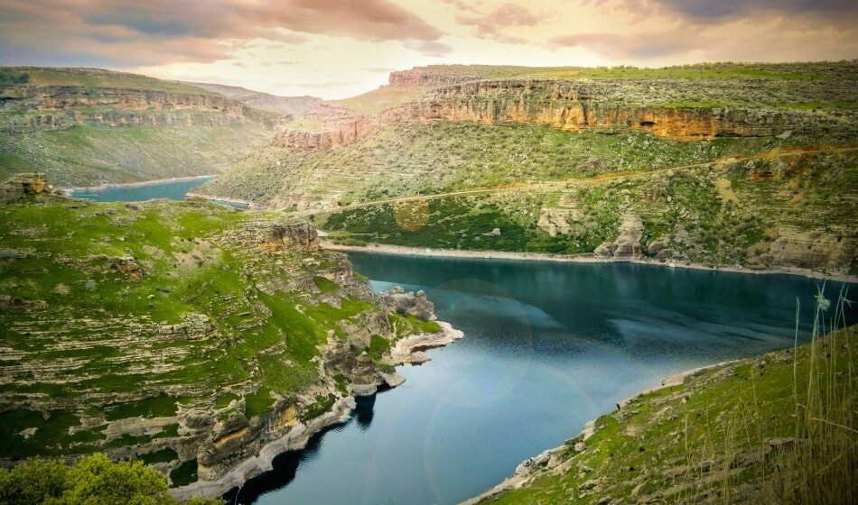
3. The upper courses of rivers have steep descents fed by a large number of smaller tributaries.
These rivers are fast flowing, and form V-shaped valleys which zigzag between interlocking spurs (raised areas of land).
4. The flow rate along the upper course often varies due to the levels of rainfall and snow melt at their source.
When snowmelt or rainfall are high this can often result in flooding.
5. When these rivers cross areas of hard rock they can often cut deep gorges which divide plateaus in two.
Rapids and waterfalls can also be common features, as erosion can take place at different rates causing the rivers’ flow to become uneven.
6. The middle course of a river begins at a loss of speed due to a shallowing of the landscape, causing the water to meander from side to side.
As it does so the water moves faster on the outside of the bend than it does on the inside. This causes the creation of river cliffs due to hydraulic action and abrasion.
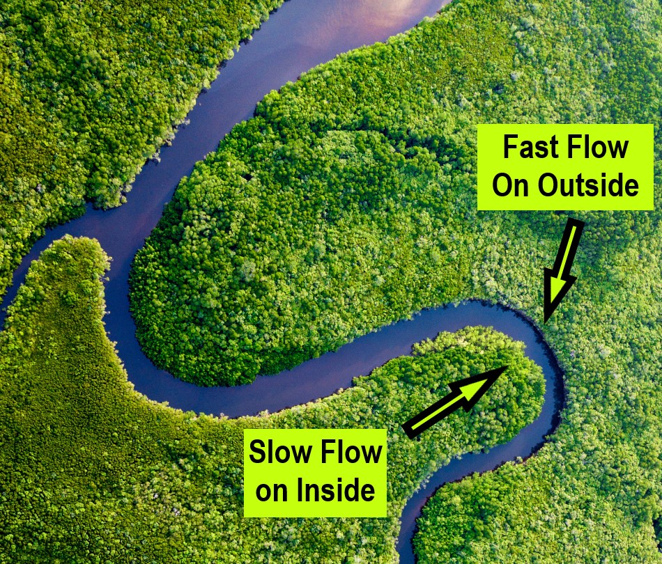
7. The slower flow of water on the inside of the river bend causes deposition (leaving material behind) leading to the creation of point bars and riffles.
A point bar, also known as a meander bar, is a feature on the inside bend of a river. They consist of sediment and other material deposited by the slower moving currents. A riffle is fast flowing shallow water, often over sediment and materials such as boulders and cobbles, breaking the water surface.
8. As the gradient of a landscape gets gentler, rivers enter their lower courses.
Rivers often begin separating (known as braiding) into many different channels which are separated by temporary islands created by the deposition of materials.
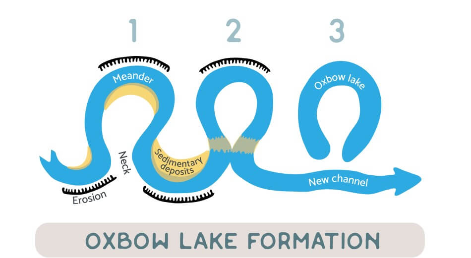
9. Rivers in their lower courses tend to meander, creating a wide, flat valley or flood plain.
On occasions, such as during floods, the river will change its course and cut off some of these meanders to form oxbow lakes.
10. Floods are also responsible for the formation of natural banks called levees.
Levees help to contain the water, helping to prevent it from where we don’t want it to flow.
11. The area where a river enters into the sea is known as an estuary.
Estuaries are often the home of many interesting and unique animals, that have adapted to the mixture of fresh water and salty sea water, which is called brackish water.
Famous Rivers in the World
There are a lot of interesting rivers in the world, but which are the most famous? Below, we’ll be looking at 10 of the most famous Rivers in the world. From the mighty Ganges to the historic Nile, these rivers have shaped and influenced civilisations for centuries. Read on to learn about these fascinating waterways and their connection to history!
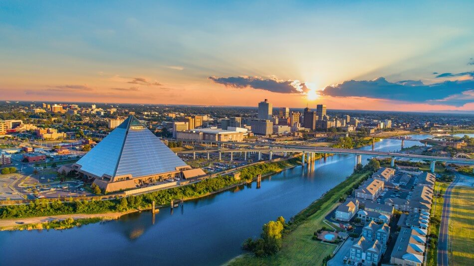
The Colorado River
- Location: United States, Mexico
- Length: 2,330 km (1,450 mi)
- Source (where it starts): La Poudre Pass (in the Rocky Mountains)
- Discharge (how much water flows through it): 22,500 cu ft/s (640 m3/s)
The Colorado River rises in the central Rocky Mountains, and flows in a south-westerly direction across Utah and Arizona, before turning south towards the Gulf of California over a course stretching around 1,450 miles.
The steep gradient of the river gives it tremendous force and has helped to carve a dramatic landscape along large parts of its course. Most famous is the Grand Canyon which has been carved by the river over millions of years.
During the 20th century large numbers of dams and other water-control projects were constructed along the river to provide water for the growing population and agriculture of the southwest. Today more than 40 million people depend on water from the Colorado. The most famous dam, the Hoover Dam, was completed in 1935 and also provides large amounts of hydroelectricity.
The construction of dams and reservoirs has had a major impact on the environment of the Colorado. Reduced water flow has dried out much of the river’s southern course. The large delta which once dominated its exit into the Gulf of California has now almost completely disappeared.
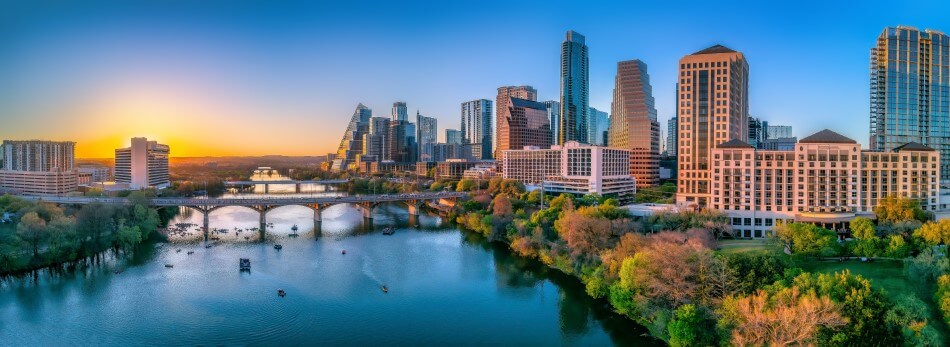
The Mississippi
- Location: United States
- Length: 3,770 km (2,340 mi)
- Source (where it starts): Lake Itasca, Minnesota
- Discharge (how much water flows through it): 593,000 cu ft/s (16,800 m3/s)
The watershed of the Mississippi River extends from the Rocky Mountains in the West to the Appalachian Mountains in the East. The source of the Mississippi is found in northern Minnesota at Lake Itasca. A small river then winds through marshes, where it grows as its fed by other lakes and streams as it flows through the city of Minneapolis.
Near St. Louis the Missouri River connects with the Mississippi, bringing large amounts of sediment that broadens out the river’s course and creates large sandbars and shoals . In Illinois the Ohio River also joins the Mississippi.
The river continues flowing south through a gap in the Cumberland and Ozark plateaus then follows a broad valley. At this point the river can be as wide as 1 mile and carries over 1 billion tons of sediment to the sea every year.
As it nears the Gulf of Mexico the river forms a large delta. The build up of natural, and man-made levees has resulted in large amounts of land here being below sea level.
The Orinoco
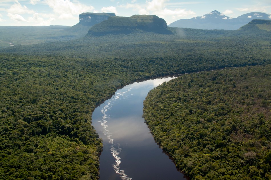
- Location: South America
- Length: 2,250 km (1,400 mi)
- Source (where it starts): Parima Mountains, Venezuela
- Discharge (how much water flows through it): 1,333,000 cu ft/s (37,740 m3/s)
The Orinoco River, the second-longest river in South America, cuts a wide arc through the nation of Venezuela. In total the river basin covers 85% of Venezuela and around 25% of its neighbour Columbia.
In its upper course the river contains the Angel Falls, the world’s highest free-falling waterfall from which water cascades down nearly 1000 meters from the mountain of Auyán-tepui. The river then flows through the Casiquiare Channel which diverts some of its waters into the Amazon.
The Orinoco then flows through a series of rapids before entering its lower course which is dominated by a series of swamps and wetlands. Still almost 300 miles from the Atlantic, the river begins to spread out into a wide delta which often experiences seasonal flooding which can change its level by almost 30 meters.
The Amazon
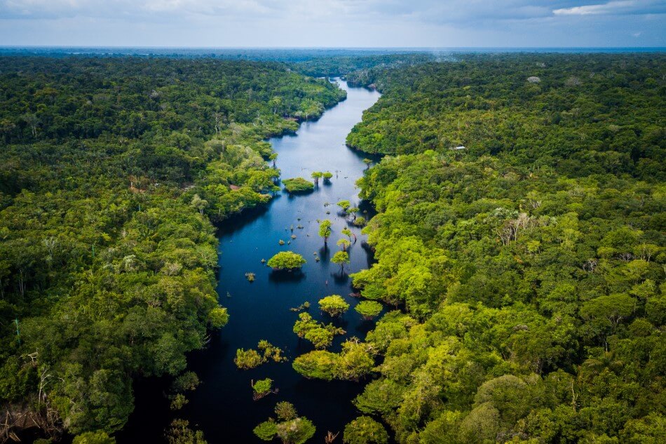
- Location: South America
- Length: 6,500 km (4,000 mi)
- Source (where it starts): Mantaro River, Peru
- Discharge (how much water flows through it): 8,100,000 cu ft/s (230,000 m3/s)
The Amazon river, along with its many tributaries, makes up the largest river system in the world. Its drainage basin covers over 40% of all of South America. At its delta over 200,000 cubic meters of water are discharged into the Atlantic Ocean every second.
The river is, on average, between 3 and 4 miles wide, however this can increase greatly during the rainy season when some parts can span over 25 miles.
The source of the Amazon lies in the Andes mountains in Peru. Many other tributaries join the river along its course carrying huge amounts of sediment with them. The longest branch of the river flows for over 4,300 miles west to east.
The Amazon river, and its surrounding rainforest, supports a huge variety of wildlife. So far over 5,000 different species of fish have been discovered, the most famous of which is probably the piranha, which feeds off other animals and even humans. Large numbers of insects, reptiles, and mammals also live in or near the river.
The Rhine
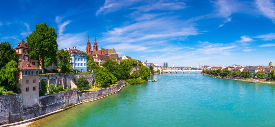
- Location: Europe
- Length: 1,230 km (760 mi)
- Source (where it starts): Reichenau, Switzerland
- Discharge (how much water flows through it): 100,000 cu ft/s (2,900 m3/s)
The Rhine river originates in the Swiss Alps then flows through Germany and the Netherlands to the North Sea. Although it is only the 12th longest river in Europe, at around 1,230 km long, it has long been one of the most important.
During ancient times the river marked the frontier of the Roman Empire. Since then, it has been a vital trade route allowing people and goods to travel deep inland. Many towns, cities, and castles were built along its course in order to control and tax trade.
In its upper course the Rhine forms deep canyons and gorges. As it travels across Germany it begins to flatten out and widen. Large stretches of the river have been shaped by humans with the goal of controlling its flow or increasing the number of ships that can sail along it.
The Congo
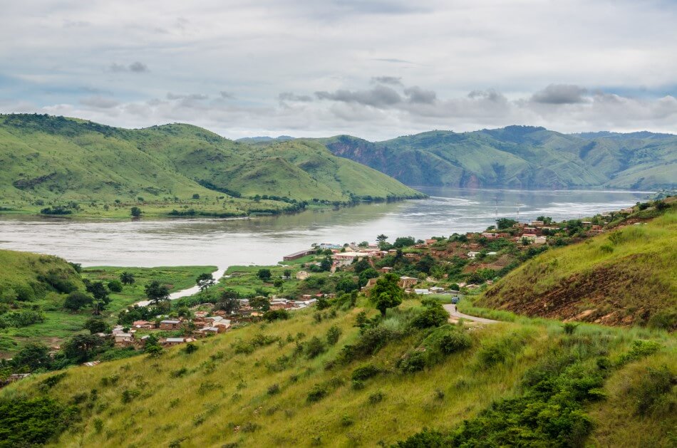
- Location: Africa
- Length: 4,700 km (2,900 mi)
- Source (where it starts): Lualaba River, Democratic Republic of the Congo
- Discharge (how much water flows through it): 1,450,000 cu ft/s (41,200 m3/s)
The Congo River flows in a wide arc through the Congo Rainforest, over a distance of over 2,900 miles. It’s drainage basin is the 3rd largest in the world while its flow rate is second only to the Amazon River in South America. Because the river’s drainage basin spans both sides of the equator it is always experiencing a rainy season, making its flow rate steady throughout the year.
The sources of the Congo can be found in the highlands and mountains of the East African Rift as well as Lake Tanganyika and Lake Mweru. Several waterfalls and rapids break up the river’s flow along its course. The flow of the river has also created several deep canyons. The river finally flows into the Atlantic Ocean near the town of Muanda.
Nearly the entire length of the Congo is navigable although certain sections are inaccessible. Most of Central Africa’s trade passes along the river with ships carrying large amounts of copper, palm oil, sugar, coffee, and cotton. The river is also, in recent years, being used to generate hydroelectric power.
The Congo is home to over 700 species of fish. Frogs and snails also exist in large numbers along with turtles and crocodiles.
The Nile
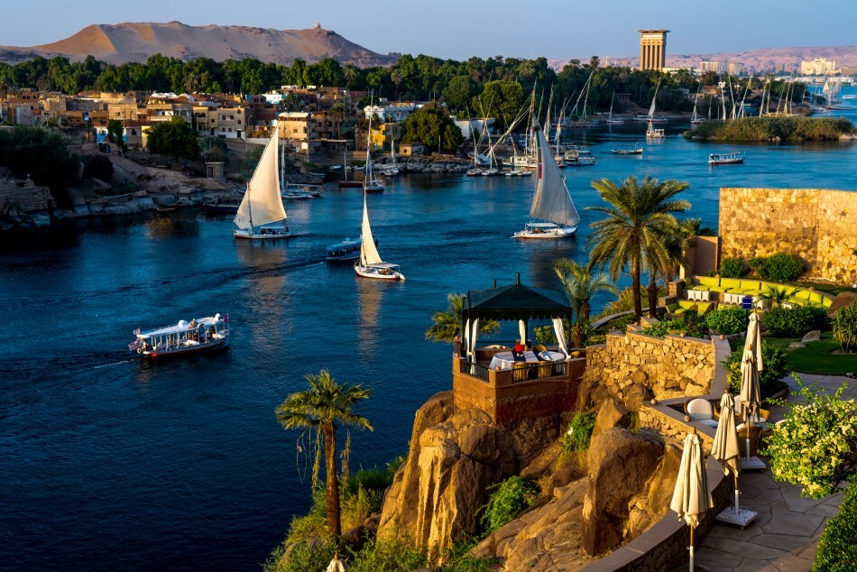
- Location: Africa
- Length: 6,650 km (4,130 mi)
- Source (where it starts): White Nile and Blue Nile, Africa
- Discharge (how much water flows through it): 71,000 cu ft/s (2,000 m3/s)
The Nile is the longest river in the world, with a length of 4,130 miles. Some studies argue that the Amazon river is longer, but no concrete evidence yet exists. Because rivers change so often, it’s incredibly hard to accurately measure their length.
The Nile has two major tributaries, the White Nile and Blue Nile. The White Nile rises in the Great Lakes region of central Africa with its direct source still unknown. It then flows through Tanzania, Lake Victoria, Uganda, and South Sudan.
The Blue Nile begins at Lake Tana in Ethiopia and then flows into Sudan from the southeast. The two rivers meet near the city of Khartoum. Although the White Nile is longer it is the Blue Nile which carries most of the river’s water and sediment.
The Nile then flows through northern Sudan and Egypt where it forms a narrow fertile valley surrounded by harsh desert. Since ancient Egypt, people along the river have depended on the annual flooding of the Nile for their survival, enriching the surrounding land and soil. In Egypt the Nile is broken up by several stretches of rapids known as Cataracts.
As it approaches the Mediterranean the Nile widens out into a large delta which is home to large numbers of birds and other wildlife.
The Tigris & Euphrates
- Location: Western Asia
- Length: Tigris River: 1,900 km (1,200 mi) , Euphrates River: 2,800 km (1,700 mi)
- Source (where it starts): Tigris River: Hazar Lake, Turkey. Euphrates River: Murat River, Turkey
- Discharge (how much water flows through it): Tigris River: 35,800 cu ft/s (1,014 m3/s). Euphrates River: 12,600 cu ft/s (356 m3/s)
The Tigris and Euphrates rivers form an area known as the Fertile Crescent, which covers large parts of the Middle East. The fertile land and reliable water supply provided by these rivers allowed for the development of the world’s first permanent farming communities and settlements around 10,000 years ago.
The Tigris River flows for over 1,100 miles, from the Taurus Mountains in eastern Turkey, through Syria and central Iraq. The Euphrates river, at over 1,700 miles, is longer and originates in northeast Turkey. It then flows south through central Syria and western Iraq. The Tigris and Euphrates then meet up and flow into the Persian Gulf.
During the 20th century a large number of dams and other water projects have been constructed along both the Euphrates and Tigris rivers. Conflicts over water supplies have been growing in recent years between the different nations dependent on the rivers. In addition, the diversion of resources has also destroyed large areas of marshland near the Persian Gulf, affecting both wildlife and the Marsh Arabs who have lived there for thousands of years.
The Ganges
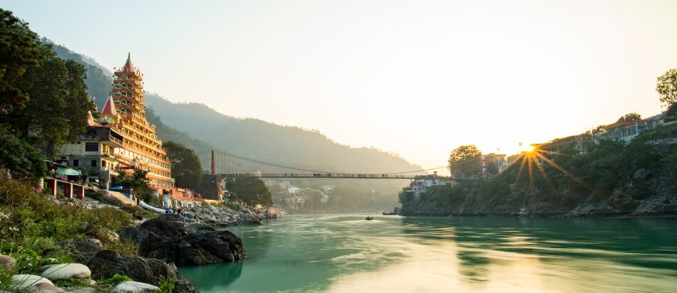
- Location: India
- Length: 2,704 km (1,680 mi)
- Source (where it starts): Gangotri Glacier, Nanda Devi, Satopanth Glacier, Kedarnath, Nanda Kot, Trisul, Kamet
- Discharge (how much water flows through it): 660,100 cu ft/s (18,691 m3/s)
The Ganges River rises in the Himalaya Mountains and flows for over 1,500 miles through northern India and Bangladesh into the Bay of Bengal. The river has the 3rd largest discharge in the world at over 18,000 cubic meters per second. Farming along the Ganges has been taking place for at least 8,000 years as people have used the fertile land surrounding it to grow large amounts of rice and wheat.
For thousands of years the Ganges has been a sacred river for Hindus who purify themselves by washing in its waters. Traditional burials also take place along the river as people are cremated and then have their remains scattered in the waters.
The Ganges has a large variety of wildlife including more than 140 species of fish, 90 species of amphibians, and many mammals including the Ganges River dolphin. Unfortunately pollution from farming and industry threatens many of these species.
The Huang He (Yellow River)
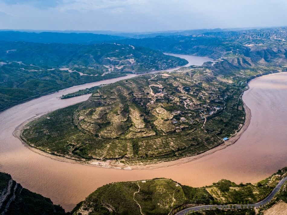
- Location: China
- Length: 5,464 km (3,395 mi)
- Source (where it starts): Bayan Har Mountains, Northwest China
- Discharge (how much water flows through it): 90,800 cu ft/s (2,571 m3/s)
The Yellow River, or Huang He, is the 2nd longest river in Asia at almost 3,400 miles long. It originates in the Bayan Har Mountains of western China and flows through central and northern China into the Bohai Sea.
The Yellow River is known as the “cradle of Chinese civilization” as the earliest examples of farming in China took place along its banks. The river is also known as “China’s Sorrow” due to the large number of devastating floods it experienced, during which huge amounts of farmland would be submerged and hundreds of thousands, or even millions, of people would lost their lives.
On its upper reaches, the Yellow River has created huge gorges and rapids. During its middle course the river begins to slow and widen depositing large amounts of sediment. At its lower course the river has been confined by a series of man-made levees so that in some places it is as much as 10 meters higher than the surrounding countryside.
During the 20th century large numbers of dams have been constructed along the river providing hydroelectric power for millions of people and factories.
River FAQs
What is the longest river?
The longest river in the world is the Nile, though it’s up for debate. The Nile is the current recognised longest river, but some believe the Amazon is longer. It’s incredibly hard to get accurate measurements due to how often rivers change.
How many rivers are there in the world?
There are millions and millions of rivers in the world, over 3.5 million in America alone, but there are only 76 that are longer than 1,000 miles.
How do rivers start?
Rivers start at a place called a ‘source’. Rivers are often formed by lots of smaller streams that eventually join together, often in high places like hills or mountains. Some begin where a natural spring occurs underground, whereas others can form from lakes, melting snow or rainfall.
Where do rivers end?
Most rivers end when they flow into a larger body of water, like an ocean or lake. The end of a river is called a mouth, but the end of a river can also be referred to as an estuary or delta. An estuary is often larger and can form where multiple rivers end. The water within an estuary is called ‘brackish’, and is a mixture of fresh river water and salty sea water.
What is the deepest river?
The Congo River, in Africa, is recorded as the world’s deepest river. In some parts it has a depth of 720 feet, or 220 meters, which means not even light can penetrate its depths.